Connecting Neighborhoods to the River with Greenways
In 2012, the Metropolitan Design Center worked with the University District Alliance, a partnership between the University of Minnesota and the four surrounding neighborhoods, to plan a network of greenways and open space that could connect to the Mississippi River. My work on the project focused on planning and conducting a series of neighborhood workshops regarding mobility to the river, researching historic waterways and the benefits of green infrastructure, and creating graphics that communicated our research and design.
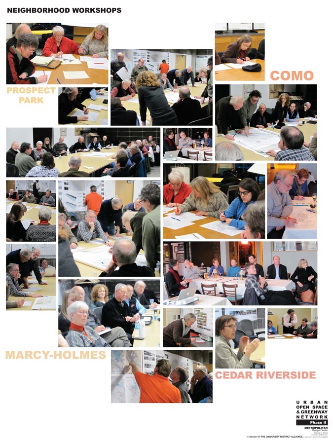
Neighborhood Workshops
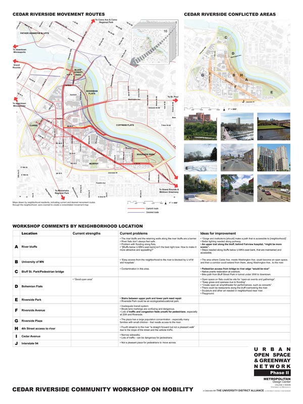
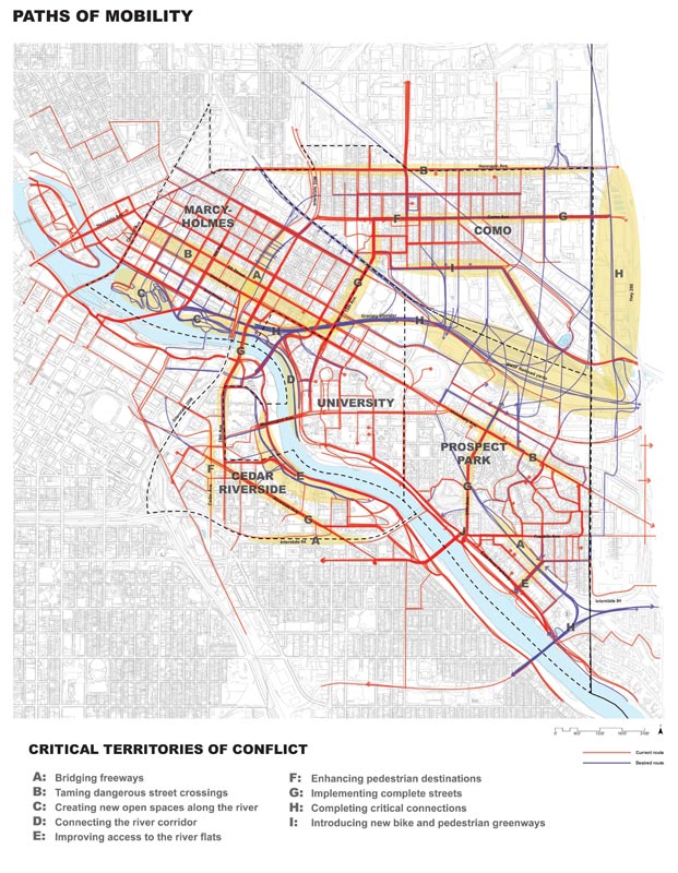
In order to understand how neighborhoods currently connect to the river, we met with each of the four neighborhoods (Como, Marcy-Holmes, Cedar-Riverside, and Prospect Park) and asked them to draw on maps the routes they currently take on foot and on bike through their neighborhood, as well as those paths they would like to take. I digitized and layered this data for each neighborhood, which allowed us to clearly understand how people move and how they would like to move. Then by layering all of the data on a map of the entire district, we were able to create a composite mobility map from which we could start to plan the new greenway connections.
Analysis & Mapping
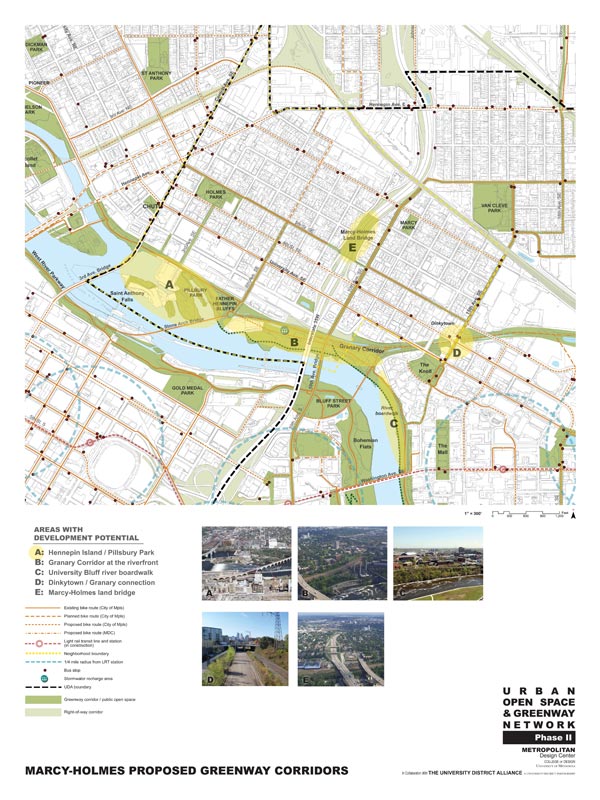
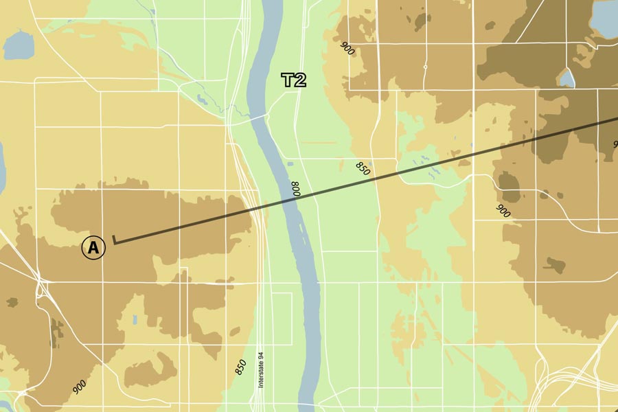
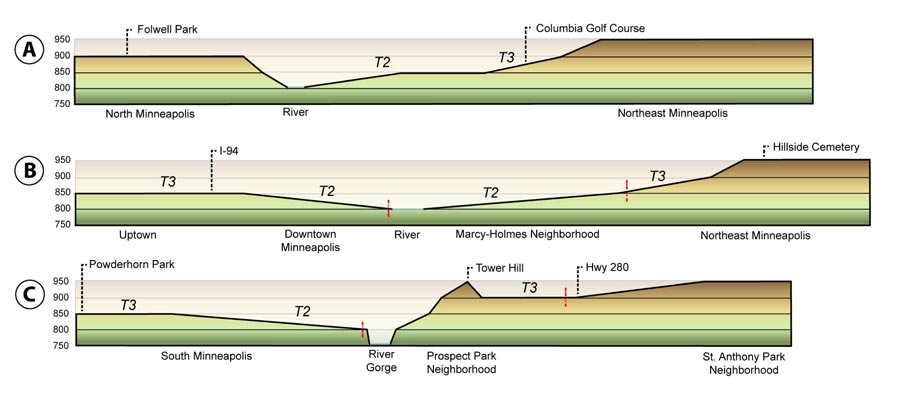
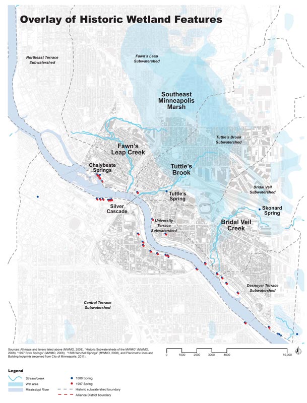
Our understanding of the landscape of the University District was focused on water. I worked with the Mississippi Watershed Management Organization to map how the wetlands, springs, streams, and waterfalls that once graced the area were tamed and often demolished as the city of Minneapolis was developed in the late 1800s and early 1900s. I mapped the topography of the University District, identifying the river terraces and discovering how the river shaped the landscape.
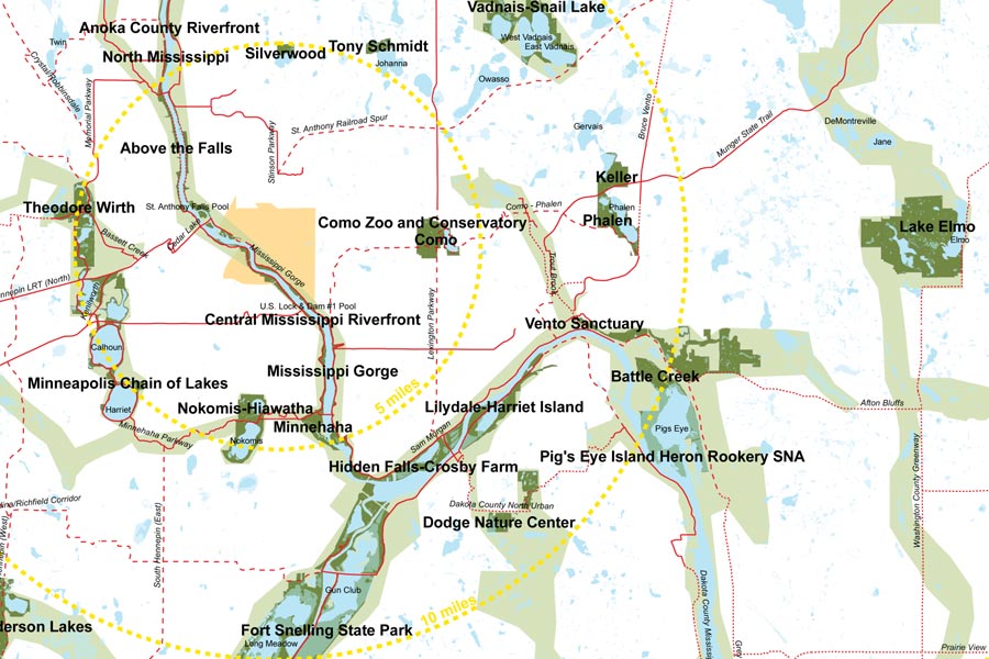
Research into the locations of regional parks and trails allowed us to see how a new greenway framework could fit into the existing network. We found that a 20-mile radius from the University district, there are 104 square miles of open space – by linking the four University District neighborhoods to this system, we could allow inner Metro residents greater access to this priceless amenity.
Research
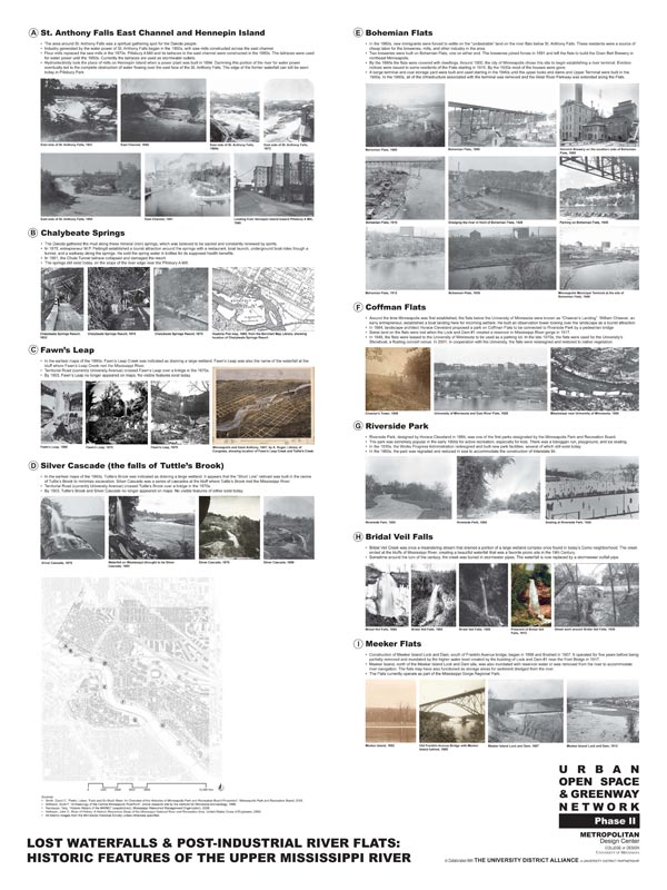
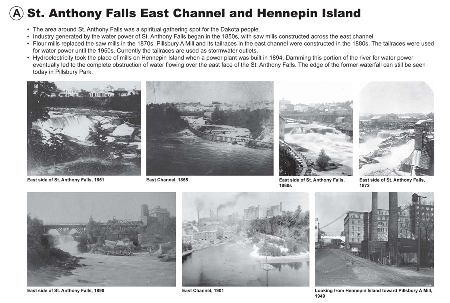
Working from what we learned from the MWMO about the former river features in the area, I researched the history of the Mississippi River in the University District. I found historic images of lost waterfalls and maps that told the history of industry and culture along the river.
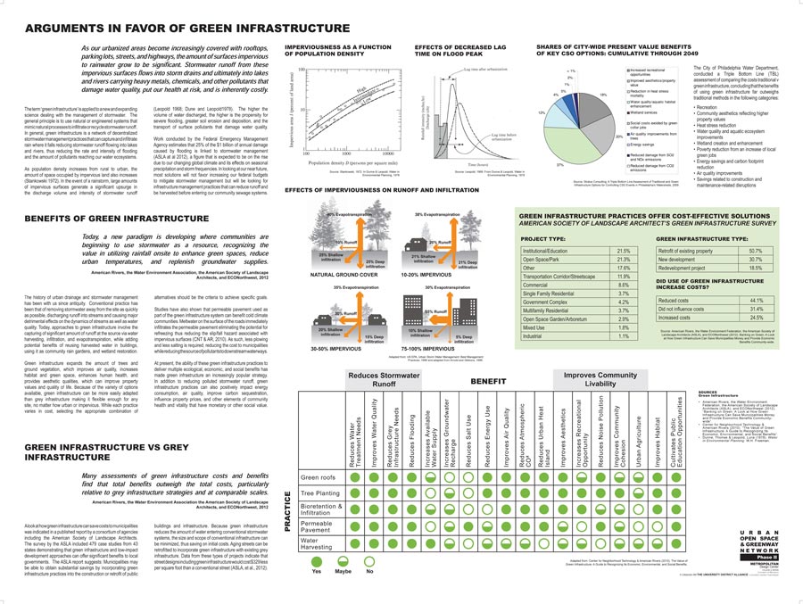
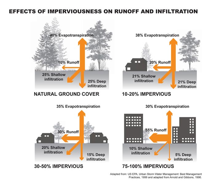
Green infrastructure became an important feature in the design of the greenway network. I researched the benefits of implementing green infrastructure, such as reducing construction costs, providing habitat, and improving quality of life.