Oxford Street is the main drag on the outskirts of the small farming town of Worthington in southwest Minnesota. While other nearby communities were shrinking, Worthington grew dramatically with a recent large influx of immigrants. Regardless, the city has struggled to attract and maintain businesses along Oxford Street and citizens must drive to other cities to find the goods they need.
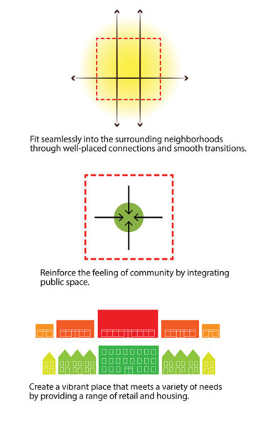
Once located at the edge of town, the Oxford Street area later developed quickly and without a comprehensive vision when the interstate was built nearby. Current issues include large underutilized parcels, haphazard land uses, an incomplete street system, and almost no infrastructure for walking and biking. The Oxford Street Redevelopment plan lays out a vision for the area that includes policy and design standard recommendations and identifies critical public investments and redevelopment projects.
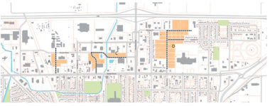
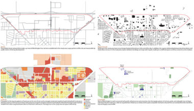
As a planner and urban designer with Cuningham Group, I played a significant part in the development of the project and the initial report. I completed the initial mapping and analysis of the corridor, creating a complex series of maps that explored how the city developed over time and how this contributed to the current environment. I assisted in the planning and leading of most steering committee meetings and public workshops. I was closely involved in the development of the recommendations for reorganizing and clarifying land uses, business access, and the street system. I also helped to identify locations for new parks and trails, housing, streets and infrastructure, and develop the associated design standards.
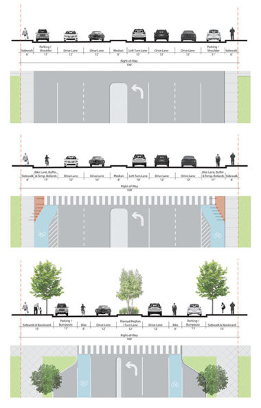
Oxford Street itself is currently overbuilt for its traffic numbers, which makes it a good candidate for a road diet. I designed alternative concepts for Oxford Street, which explored new features such as bike lanes, temporary or permanent bump-outs, on-street parking, and planted medians.
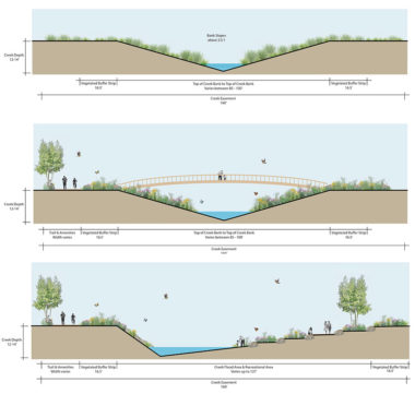
Okabena Creek, which runs through the site, is currently treated as a drainage ditch, engineered to carry stormwater away from the area as quickly as possible. While this fulfills the important function of mitigating potential flooding of the surrounding low-lying neighborhoods, I developed two alternative designs that would also allow the creek to provide important recreational and ecological functions.
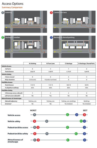
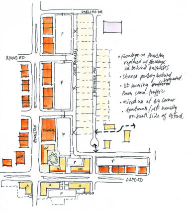
Oxford Street’s center median and businesses’ separate driveways created an access problem. In order to facilitate discussion and decision-making at a stakeholders’ meeting, I put together a presentation that tracked imaginary travelers in each of the four streetscape alternatives and rated their paths based on qualitative measures that aligned with stated community goals. This allowed the group to understand the implications of each alternative and use this information to make the decision that was best for their community.
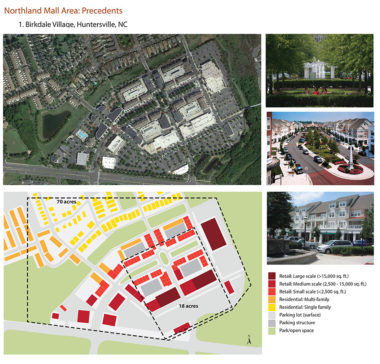
Northland Mall, now defunct and mostly empty, takes up 18 acres of land along Oxford Street. I researched precedent studies to generate ideas for how the site could be redeveloped to provide mixed uses, including housing, a variety of sizes of retail, and new open space.
